The GAMUT Network - GAMUT Fact Sheet
Gradients Along Mountain to Urban Transitions
GAMUT Background
iUTAH researchers developed and deployed an ecohydrologic observatory to study water in ‘Gradients Along Mountain to Urban Transitions’ (GAMUT). The GAMUT Network measures aspects of climate, hydrology, and water quality along a mountain-to-urban gradient in three watersheds that share common water sources (winter-derived precipitation) but differ in the human and biophysical nature of land-use transitions. See this published paper for more information on the design and implementation of GAMUT.
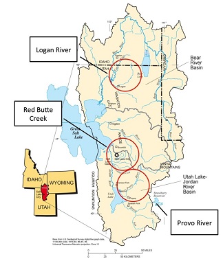
GAMUT Watersheds
There are three watersheds with sites in the GAMUT Network. Click on the links to preview data and learn more about each watershed.
GAMUT Monitoring Sites
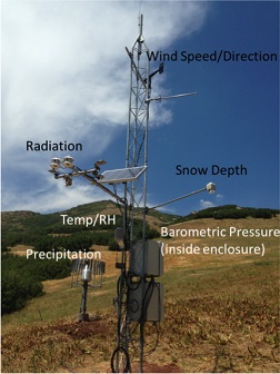
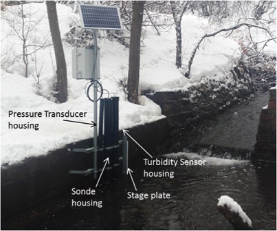
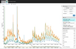
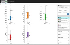
GAMUT includes state-of-the-art sensors at aquatic and terrestrial sites for real-time monitoring of common meteorological variables, snow accumulation and melt, soil moisture, surface water flow, and surface water quality. These figures show a typical GAMUT climate site and a typical GAMUT water quality site.
Cyberinfrastructure
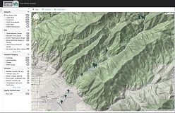
The collection and dissemination of data from the GAMUT Network is supported by various cyberinfrastructure applications illustrated by this workflow and described in this published paper. Access to real-time sensor data from the GAMUT network is available to researchers, educators, and other stakeholders via online visualization .
Applications
GAMUT data have been used as preliminary results for grant proposals and are included in manuscripts for publication. GAMUT data are also being used by other stakeholders. The Utah Department of Environmental Quality’s Division of Water Quality has used GAMUT sensor output to screen for water quality violations and has used to GAMUT as a guide for their own continuous monitoring and data management efforts. Several university faculty have used GAMUT data in teaching their classes. Synergy is also achieved with other climate and water monitoring being conducted within the GAMUT watersheds.